Alice Springs Pictures
Outback Photo Gallery
More than just Alice Springs pictures...
This page has pictures of Alice Springs itself, but you will also find photos of the beautiful regions surrounding "The Alice"
"Alice", as the locals call it, is so worth a visit! Not to see the town itself, not for the Alice Springs accommodation (plenty of other options in the Outback), and not because it's the closest town to Ayers Rock.
Visit Alice Springs to see some of Australia's most stunning landscapes and discover the intriguing flora and fauna of the desert.
And although it certainly is desert country, I feel that somehow the word desert just doesn't do it justice...
Alice Springs Pictures 1
View from the MacDonnell Ranges
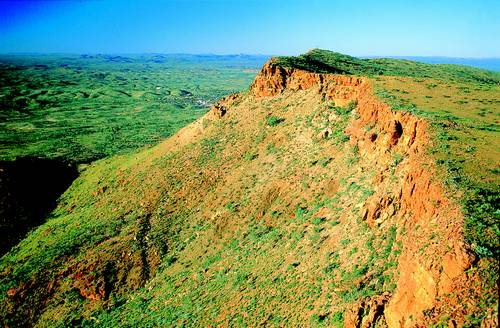
This is what Alice Springs looks like from the top of the MacDonnell Ranges. Not much of it, is there? Can you even see it? 5 blocks all up, if I remember correctly...
That such a tiny place should be the "capital of the Outback", and in fact is the only major town within over thousand kilometres in any direction...
When I arrived in Alice Springs on my very first trip to Australia, that's when the reality of the vast dimensions of the Australian Outback really hit home.
Alice Springs Pictures 2
Aerial view of Alice Springs
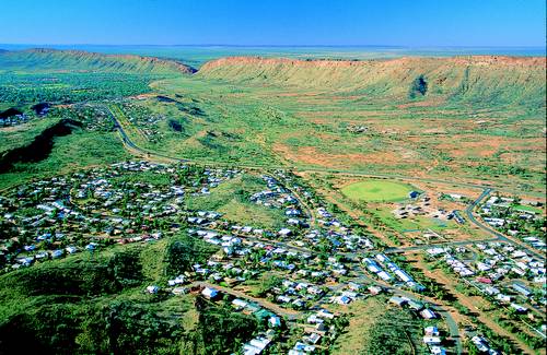
This is it, all of it. You can see the town itself a bit better in this photo, and the MacDonnell Ranges stretching to the East and the West. Most of the spectacular nature and national parks, and other scenic attractions around Alice Springs, are part of the Western MacDonnell Ranges.
I fail to get excited about any towns or cities, but I do get excited about the MacDonnell Ranges. I love nature, and I just can't resist these incredible Outback landscapes and colours... You'll see below what I mean.
Alice Springs Pictures 3
Heavitree Gap
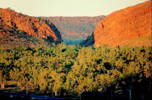
Did you notice the gap in the ranges in the picture above this one? Here it is again. It's called Heavitree Gap, and it is the most scenic location within Alice Springs, very close to the town centre.
(Coming to think of it, all of Alice Springs is close to its centre...)
Several Alice Springs accommodation providers are jostling for your attention at the base of these stunning ranges, featuring Heavitree Gap in their name.
But really, the gap makes for nice photos, but it can't compete with the views that a trip along the Larapinta Drive will offer...
Alice Springs Pictures 4 + 5
MacDonnell Ranges
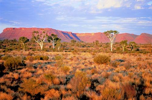
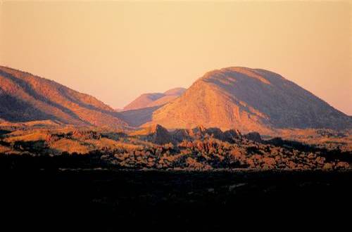
Of course, sunrise, and sunset...
I have already talked about this on other pages on this website: the light in the Australian Outback is very harsh. It will drain all the colours from photographs taken during the middle of the day.
When the sun is high in the sky there are no shadows. Everything is brightly lit, valleys as much as ridges, they all appear the same. The country will look flat, and your photos will look boring, no matter how spectacular the scenery really is...
(Didn't want to believe it, which, ahem, is why the photos on this page are not my own...)
Alice Springs Pictures 6
Chambers Pillar
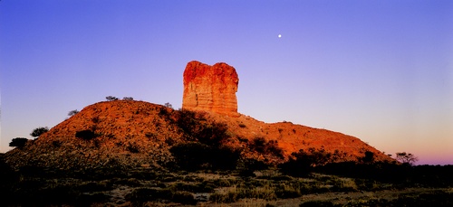
This is what a bit of morning sun can do to a rock standing around in the Australian Outback (as they do...).
The natural sandstone formation, located 165 km south of Alice Springs, is called Chambers Pillar, and this how OATG reader Joy W. remembers the night and the sunrise:
"We went and camped the night with the dingoes, but what is so amazing about this Pillar is the sunrise. It's a big stone that comes out of the ground like a big column and with the early sun on it, it just glows. It only lasted about 5 minutes but was fantastic and great for photography. That was about 7 years ago. It was a highlight of my trip to Alice Springs."
I think this is one of the reasons I like camping so much: it makes it easy to be in the right place at the right time. (I'm not a morning person...)
If camping is not your cup of tea, but waking up in the MacDonnell ranges sounds attractive, consider the lodge at Glen Helen Gorge:
Alice Springs Pictures 7
Glen Helen Gorge
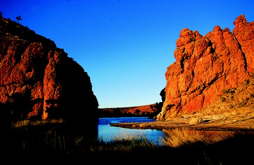
Glen Helen Gorge is one of several gorges and waterholes near Alice Springs. Yes, there is more than "just" desert, even in central Australia...
Glen Helen is a 368 hectare nature park located some 130 km west of Alice Springs in the Western MacDonnell Ranges. The water you see is the Finke River, called Larapinta by the local Aborigines (I mentioned the Larapinta Drive above.)
The Finke River is supposed to be the oldest river in the world according to some (no idea how you would determine that, but it sounds good...). It starts here in the MacDonnell Ranges, and ends in Lake Eyre, the big salt lake in South Australia.
Lake Eyre is usually dry, and so is a lot of the Finke River... But Glen Helen Gorge is a permanent waterhole, one of six along along the whole river...
Read more about Alice Springs, Australia and the nearby attractions.
Next page: Pictures Of Ayers Rock/Uluru Photos
Australian Outback Pictures Gallery main page
Go to Outback Australia Travel Guide home page
(Copyright for all pictures on this page belongs to the Northern Territory Tourist Commission.)


